
An Insider’s Guide to Hualien: Taroko National Park, River Adventures, and Pristine Landscapes
Hualien is home to pristine wilderness, Taiwan’s clearest turquoise-colored rivers, unique indigenous culture, and of course, the beautiful and highly accessible Taroko National Park.
As Taiwan’s most impressive natural attraction, Taroko National Park is the reason most multi-day tours include at least a half day in Hualien. Home to the world’s largest marble canyon, many of the 100 Peaks of Taiwan, and countless world-class hiking trails, waterfalls, and beautiful vistas, the park is, without a doubt, worth a visit.
The rest of the county is also filled with beautiful natural landscapes like the high-mountain flower fields of Yuli Township, the dramatic coastal vistas of Qingshui Cliff, and the ecologically rich oceanside of Shitiping Recreation Area.
Hualien is also a hot spot of outdoor activities. If the water here makes you want to jump in, don’t worry, the local adventure industry here has you covered—many rivers around Hualien are top destinations for the popular year-round activity of “river tracing”. River tracing is an activity which is a combination of hiking, wading, climbing, swimming, and jumping into the crystal clear deep pools that Hualien is famous for.
Finally, both Hualien City and small villages around the countryside are home to delicious hole-in-the-wall eateries, many of which serve unique indigenous flavors that are hard to find elsewhere in Taiwan.
If you’re pressed for time and want to visit Hualien, we recommend our efficient day tour of Taroko Gorge, which departs from Taipei four times a week and takes you around Hualien’s most dramatic sights.
For a more in-depth experience, please contact us with a list of your must-visit destinations and allow us to craft a customized private tour of Hualien for you.
Taroko National Park
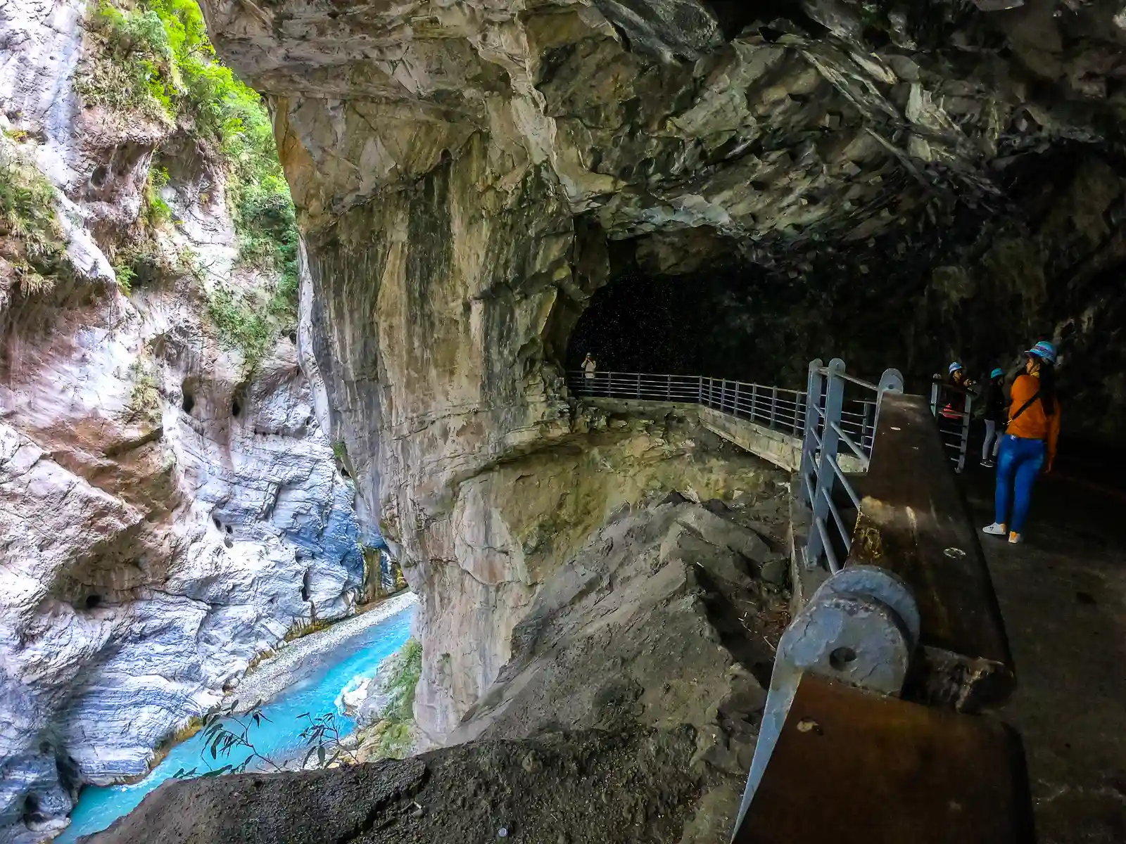

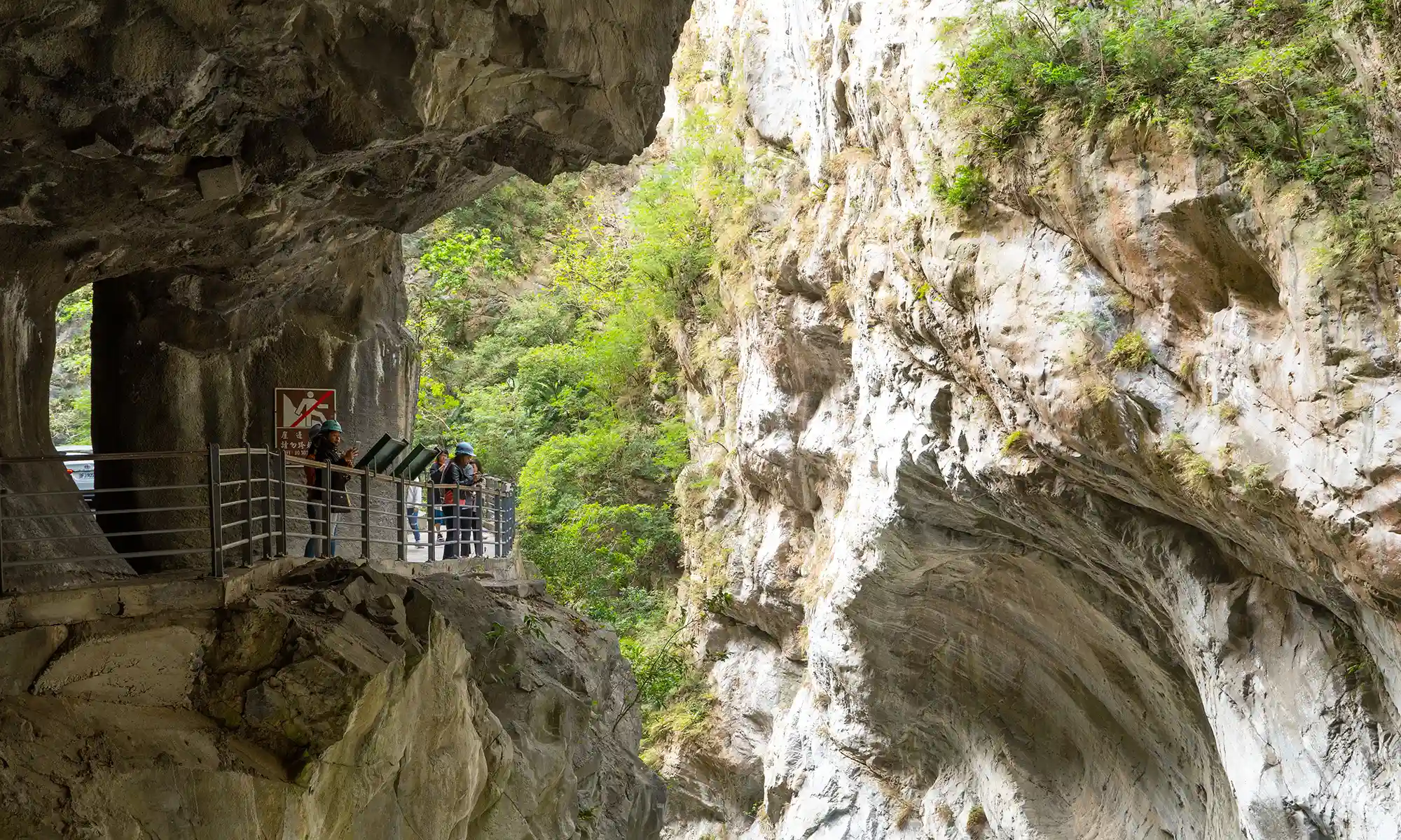
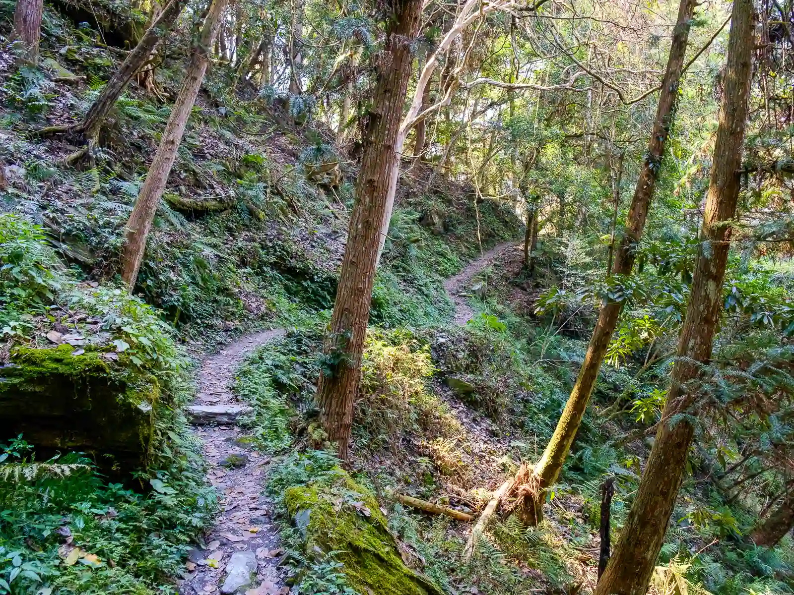
With its cliff faces, deep gorges, and a plethora of scenic spots, Taroko National Park offers a diverse range of experiences for both casual visitors and seasoned trekkers.
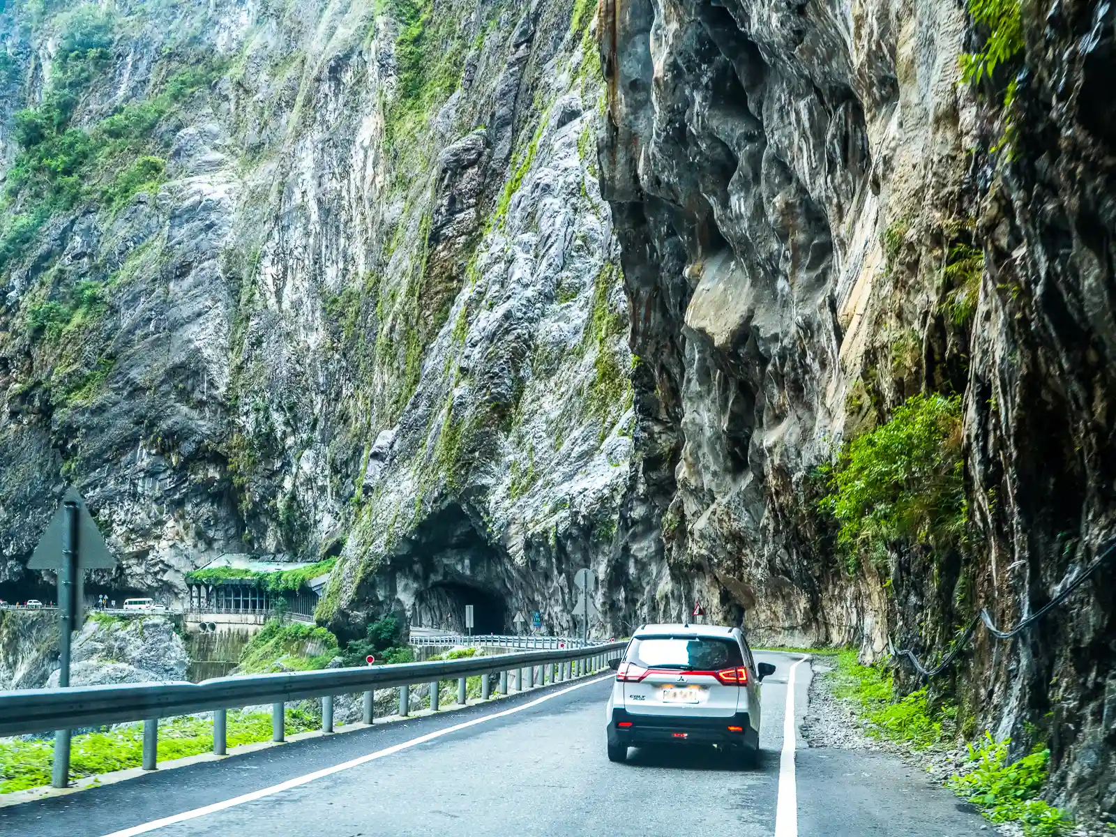
While Taroko National Park’s mountains are notoriously steep, a good portion of the sights in Lower Taroko Canyon can be visited by car, and the park is also filled with a good selection of relatively easy hiking trails.
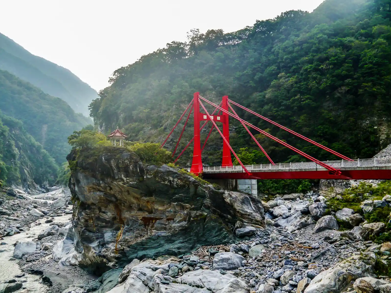
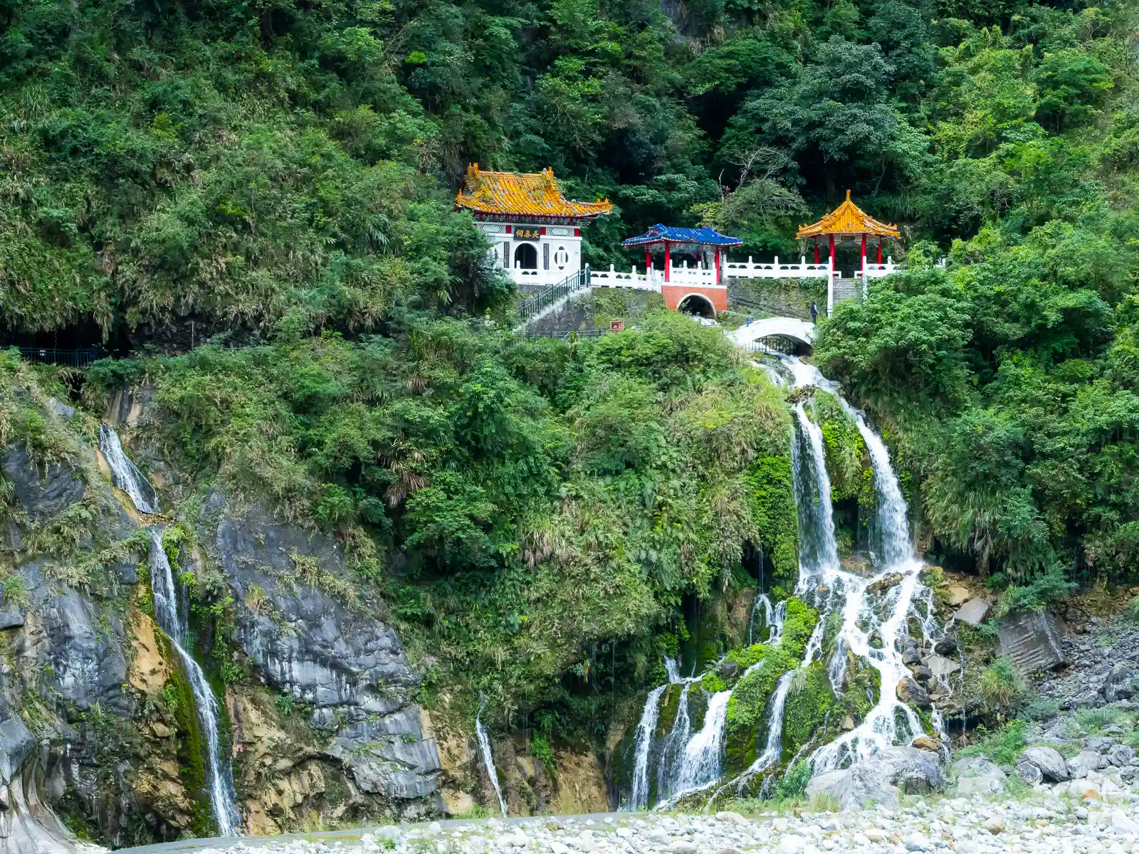
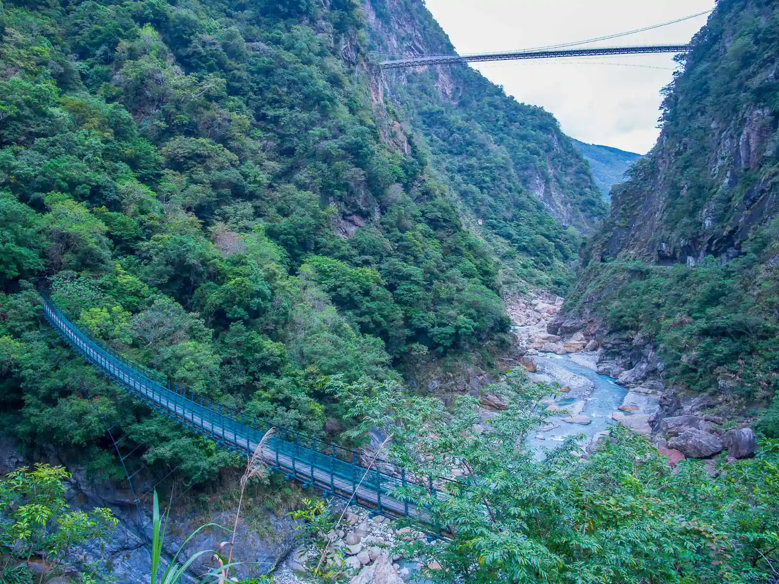
For those who prefer a more laid-back experience, the region of Taroko Gorge between Taroko Visitor Center and the village of Tianxiang is a haven. From the breathtaking and poetic Eternal Spring Shrine (Changchun Shrine), which has been built over a fan-shaped waterfall that cascades gently down to the grand Liwu River below, to the newly built Buluowan Suspension Bridge, which provides visitors with spectacular bird’s eye views of the canyon directly below, the accessible sights of Taroko Gorge remind visitors of the magical allure of nature.
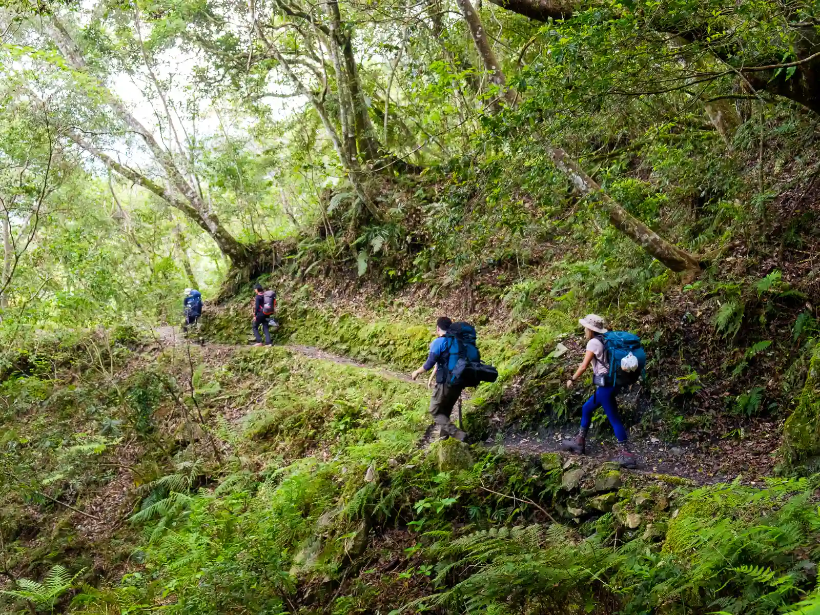
Of course, challenging hikes also exist. The historic Zhuilu Old Trail, which is best for daredevils and hardened hikers, climbs the cliffs of Taroko Gorge and offers unparalleled and heart-stopping views. Further up in the higher reaches of Taroko National Park, alpine trails complete with lean-tos and shelters lead to many of the 100 Peaks of Taiwan, offering yet another way to experience Taiwan’s high mountains.
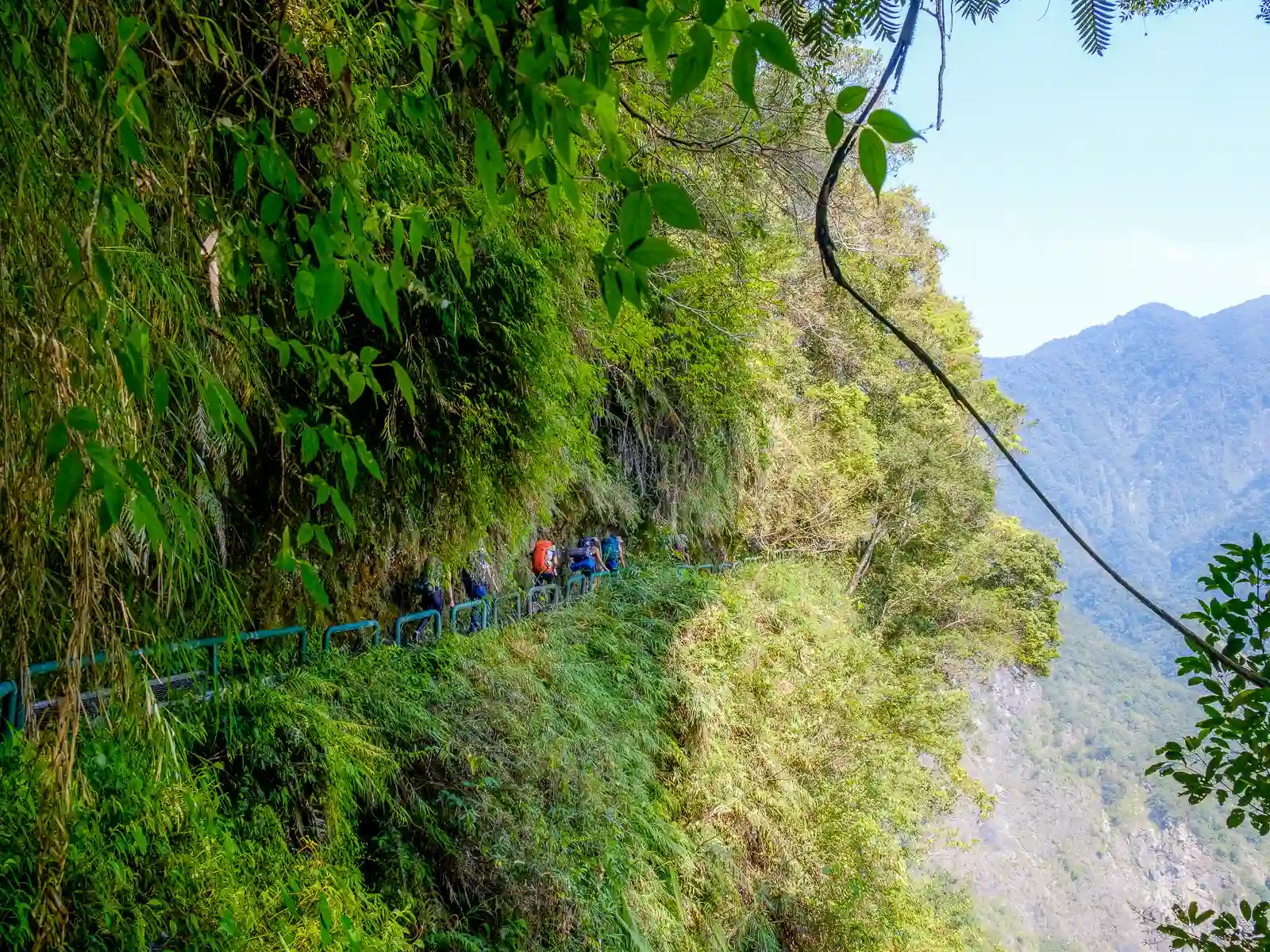
Zhuilu Old Trail

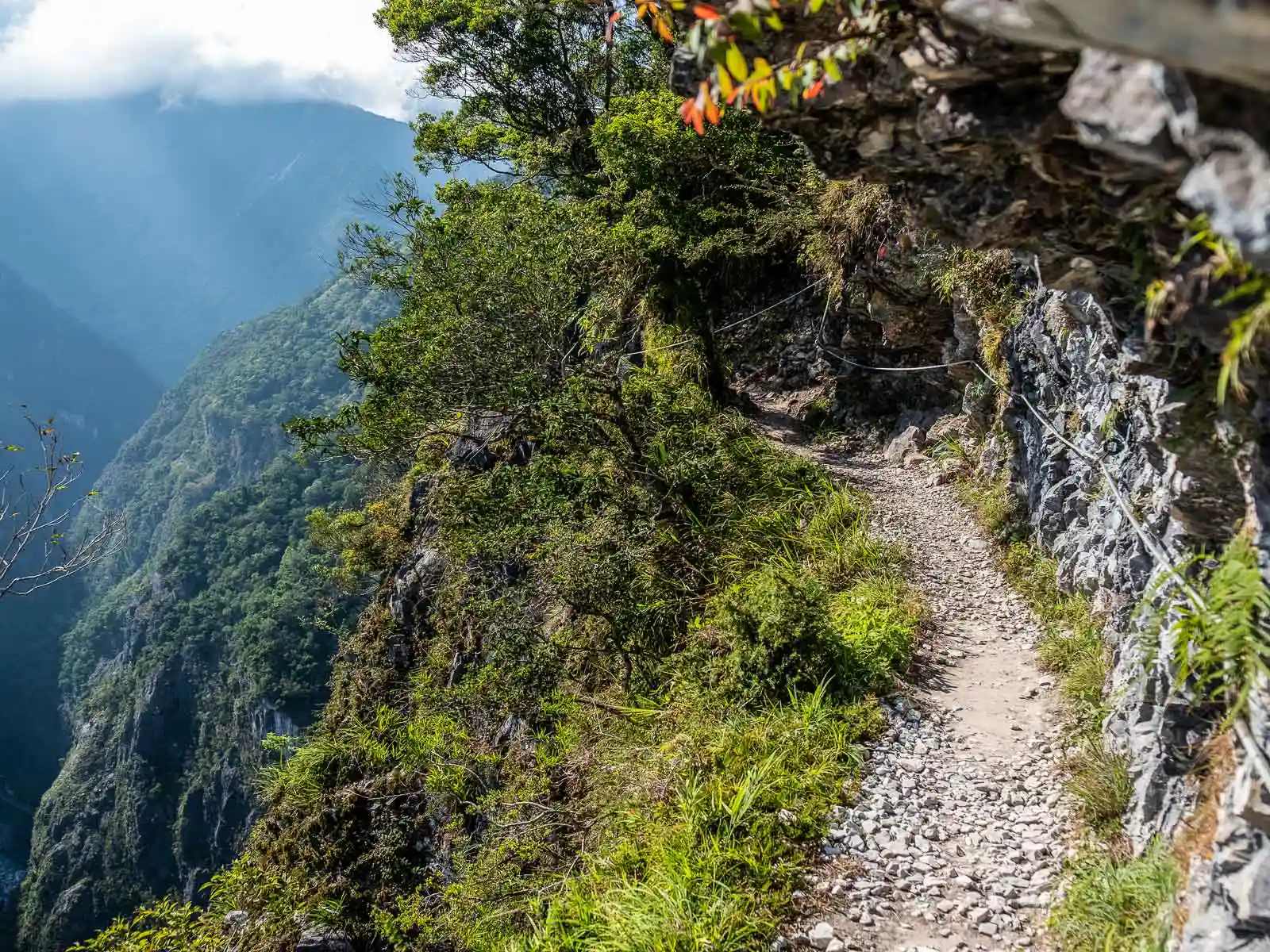
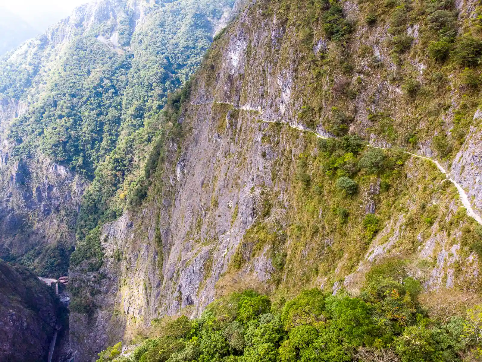
The Zhuilu Old Trail is Taroko National Park’s most famous day hike, and one of our Top 5 Hiking Trails in Taiwan.
The short and steep trail offers visitors the unique opportunity to relive the complex history of Taroko Gorge by walking a section of the Old Cross-Hehuan Mountain Road. Prior to the existence of the Central Cross-Island Highway, which now allows for vehicle traffic, this old Japanese path was the only way through the gorge.
The route passes through ruins of Japanese police stations, across dramatic suspension bridges, and offers breathtaking views of the heart of Taroko from over three times the height of the Buluowan Suspension Bridge.
However, this trail is not for the faint-hearted; the final half-kilometer involves walking on a ledge where the trail narrows to one meter or less in width. In fact, parts of this section had to be blasted into cliff walls with dynamite by Truku indigenous workers using nothing but ropes. Due to the demanding nature of this trail, aspiring hikers should be moderately fit and comfortable with walking along exposed ledges.
Please note, due to extremely high demand, Taroko National Park has implemented a permit system for this hike. Permits may be applied for up to two months in advance (four months if everyone on the team is a foreign national) and generally book up quite fast.
Booking a guided hike with us to learn in-depth about the history of Taroko National Park.
Qingshui Cliff


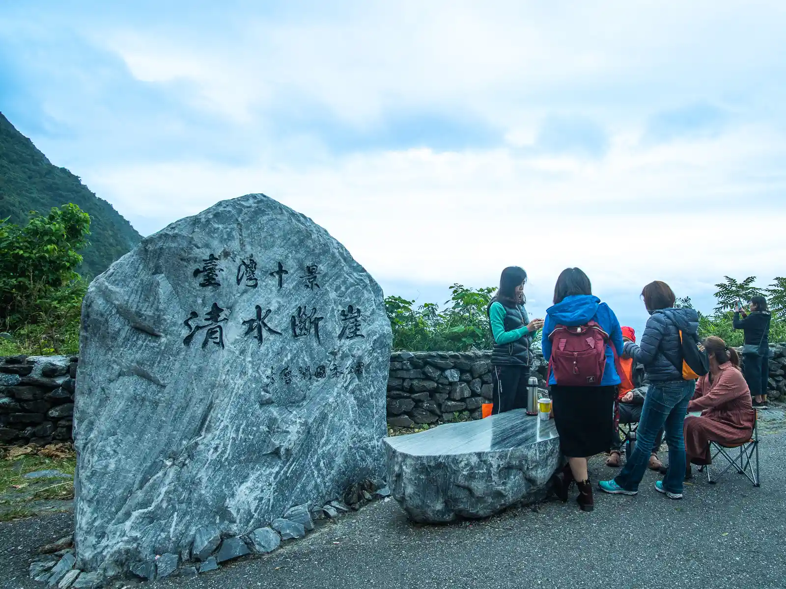
The spectacular Qingshui Cliff towers majestically along the coast between Hualien and Yilan. Located outside of Taroko Gorge, but still within the limits of Taroko National Park, the cliffs can be reached via the Suhua Highway. After a series of short tunnels, two major viewing areas built into the middle of the cliffs offer the opportunity to stand right below these impressive cliff faces.
During the summer, the best way to experience the magic of these cliffs is by booking a guided paddle tour on kayak or stand-up paddleboard. Tours depart as early as a half hour before sunrise in order to experience the surreal golden-orange glow of first light on the cliffs from the water.
The Golden Grotto
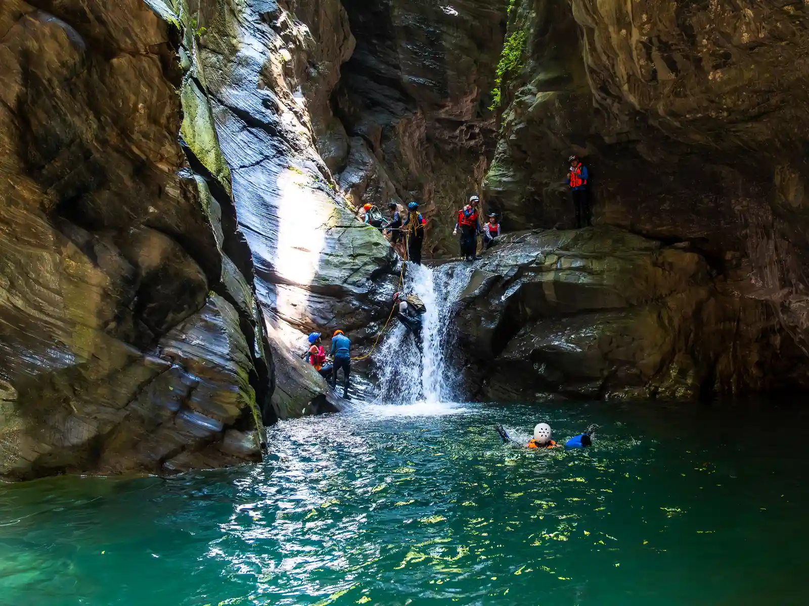
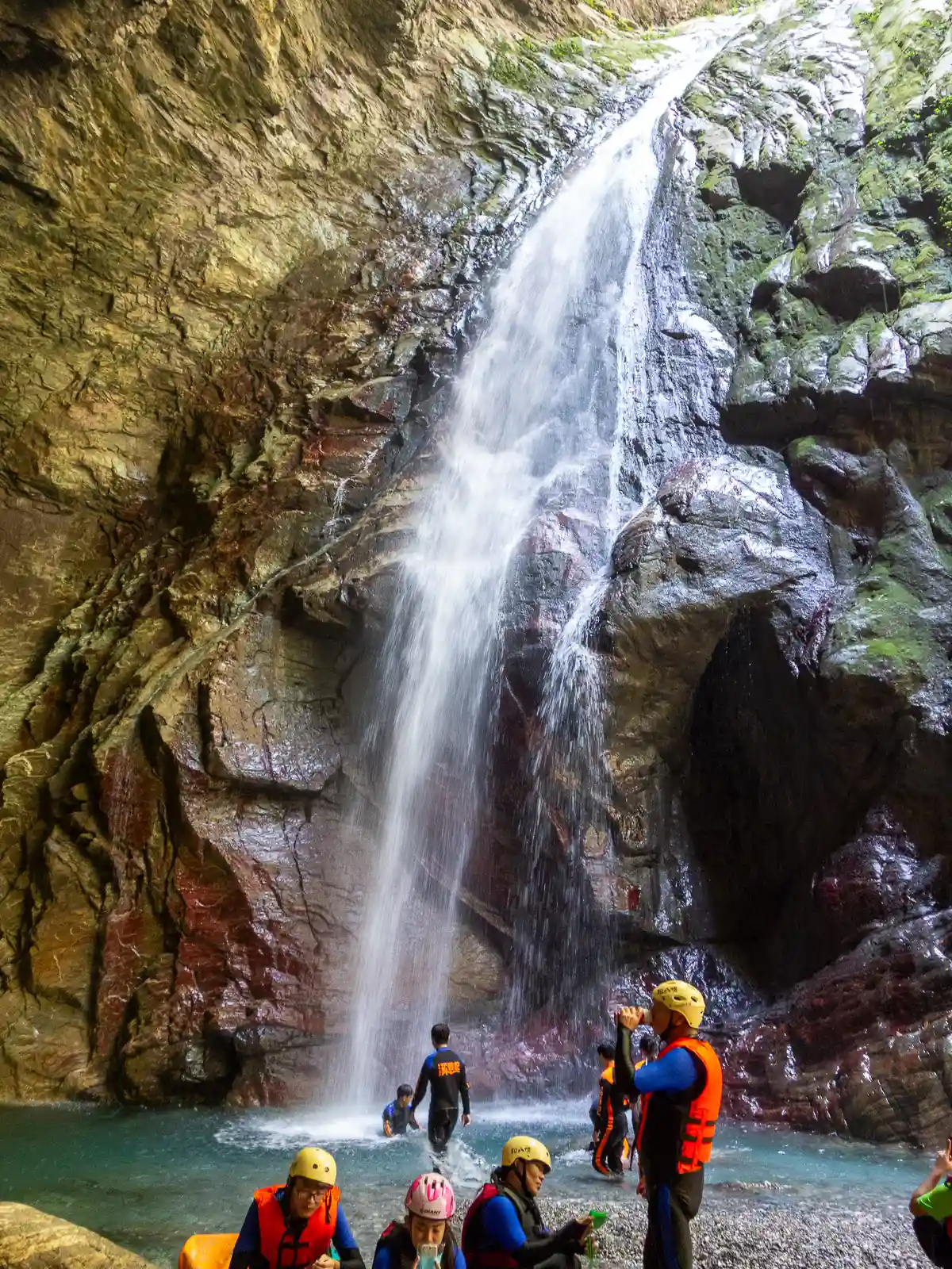

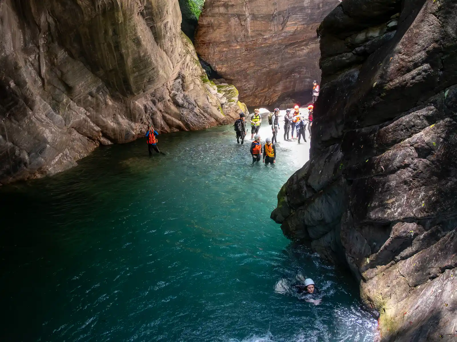
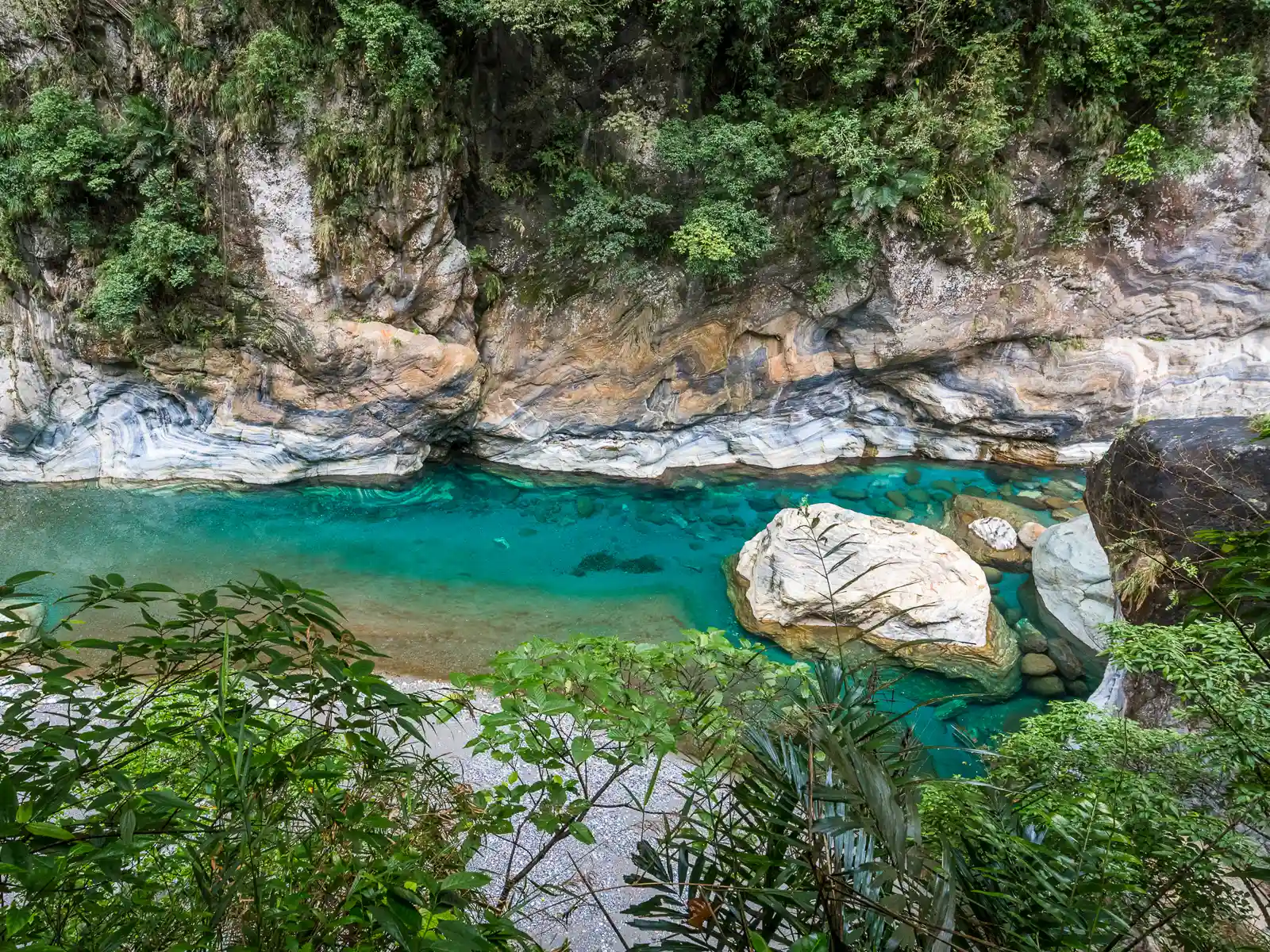
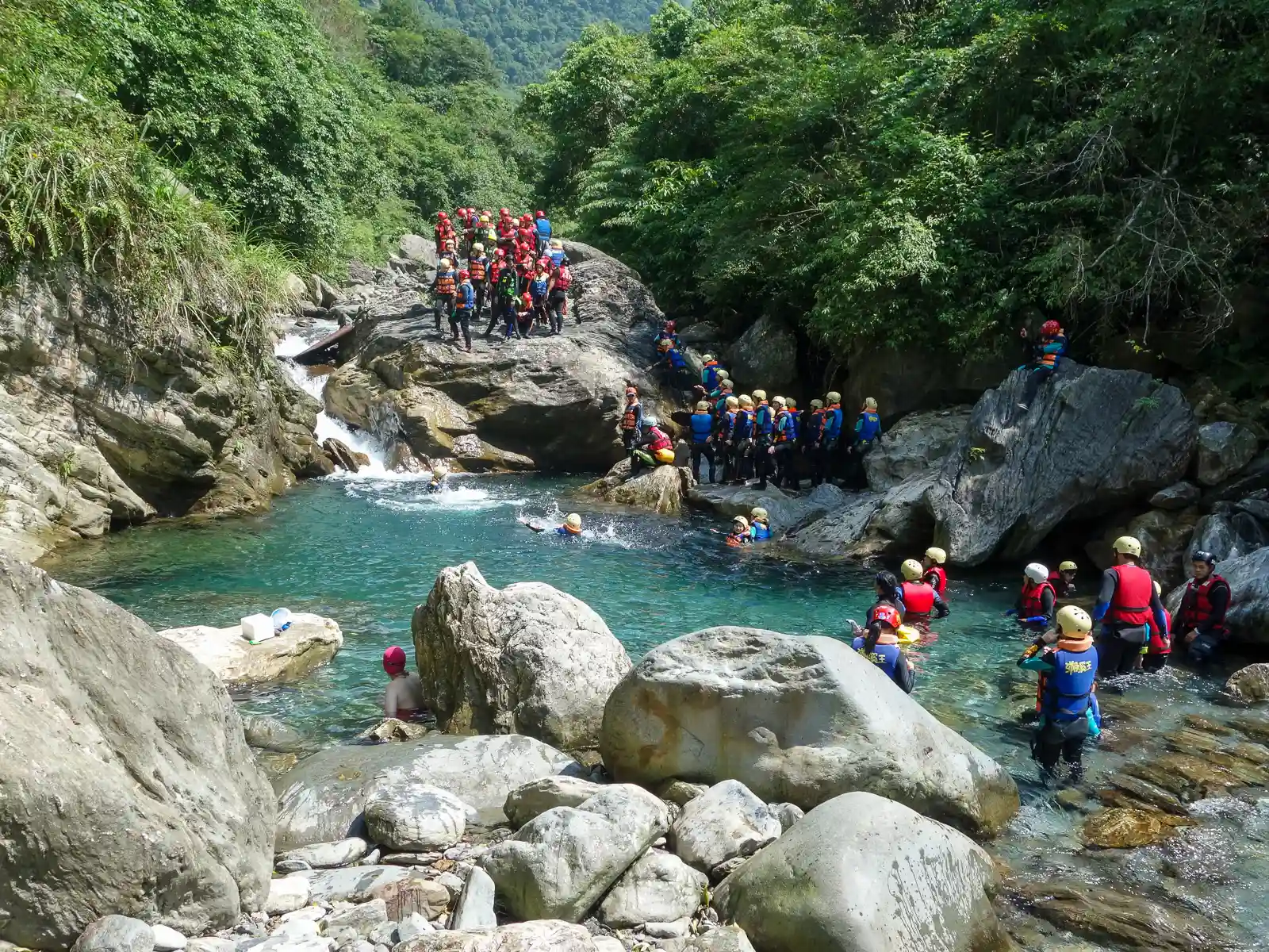
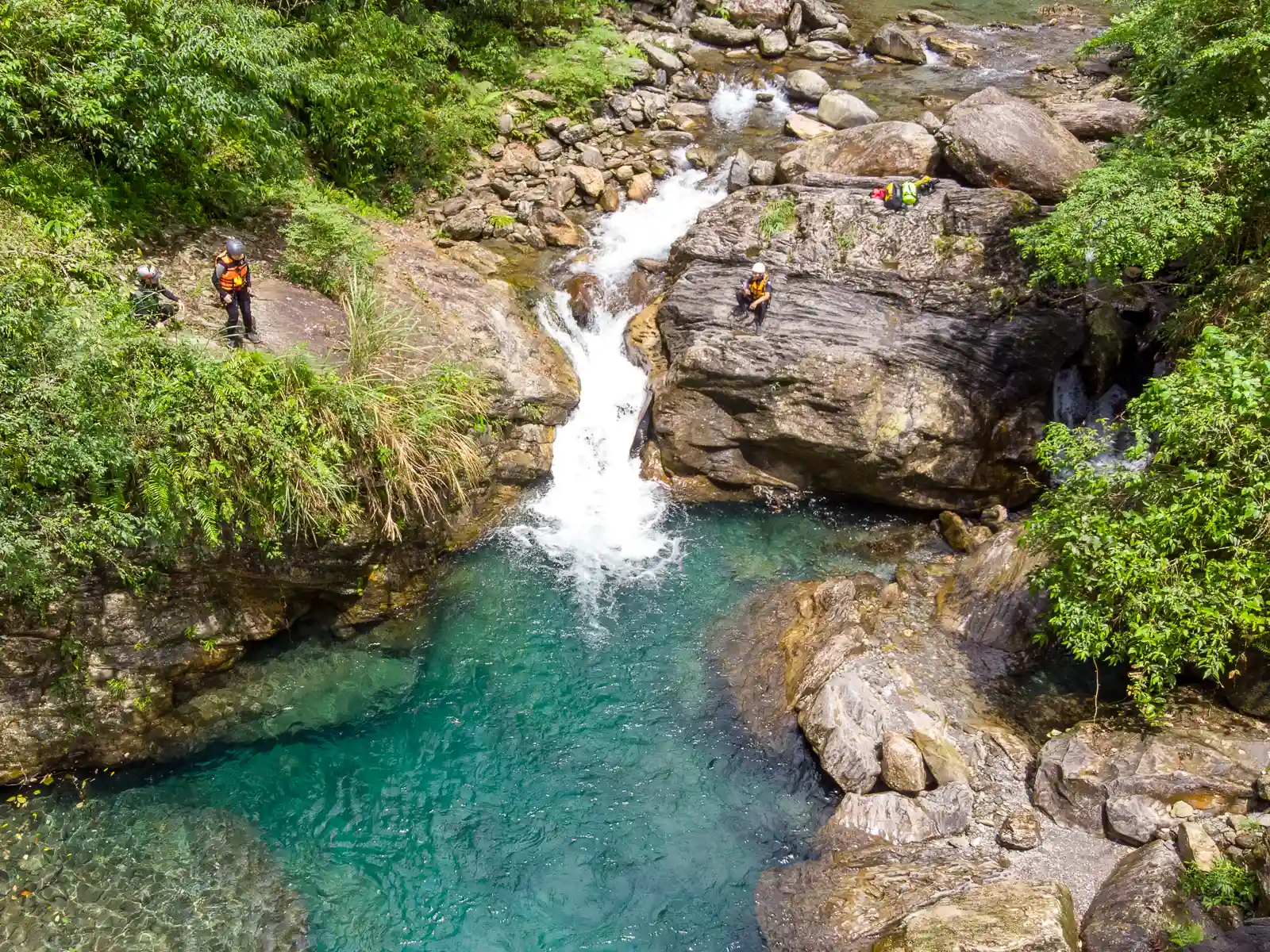
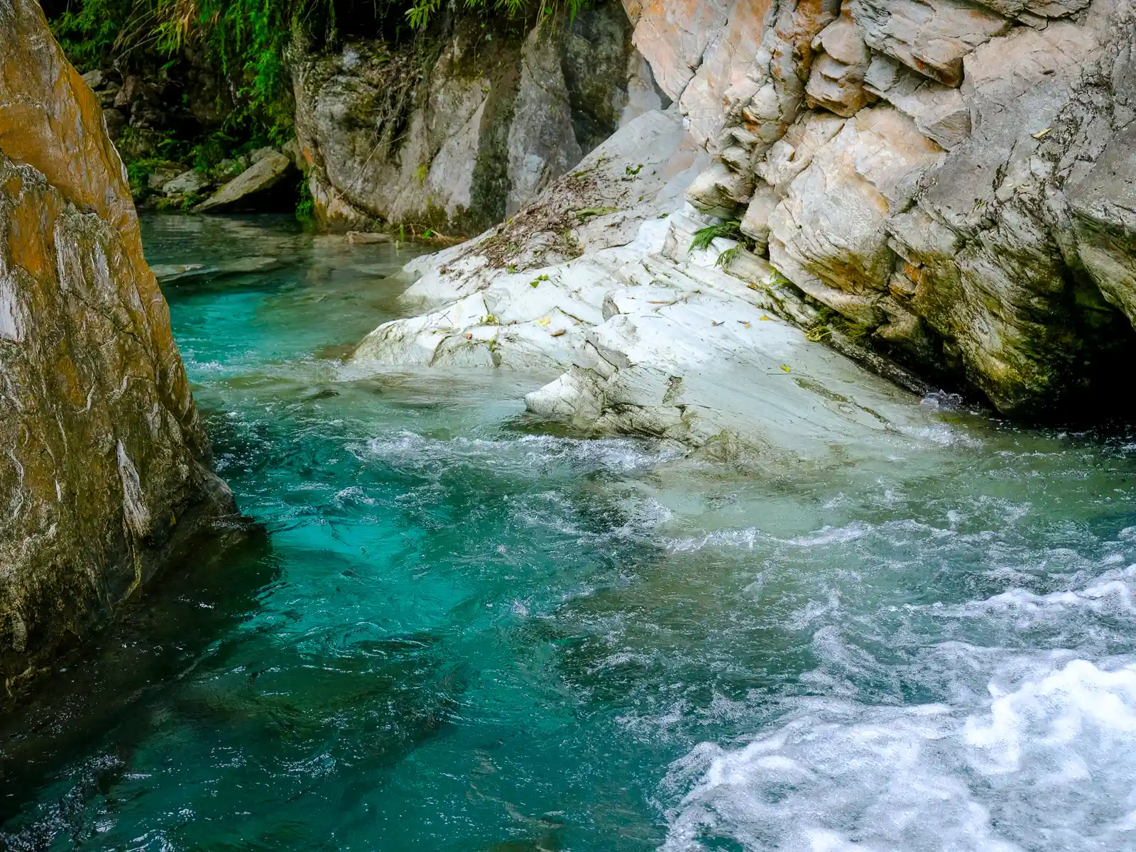
The Golden Grotto is a beautiful slot canyon with multiple waterfalls and deep pools of pristine azure-colored water. Located about 4 kilometers up the Sanzhan South River, getting there involves a combination of hiking, river wading, swimming and climbing (this activity is locally called “river tracing”). The Golden Grotto is both Hualien’s most rewarding, and most challenging river trace.
It’s possible to book a tour to visit the Golden Grotto year-round, but we particularly recommend experiencing this full-day adventure during the summer and fall when every crystal clear pool will be delightfully refreshing. During the winter, the tour operators provide wetsuits.
Qixingtan Beach
Qixingtan Beach is an expansive crescent-shaped pebble beach that is located along Hualien’s scenic northern coast. While Qixingtan Beach refers to the section of beach that is right by Hualien Airport, a stretch of beaches actually runs all the way to the mouth of the Liwu River at the entrance to Taroko Gorge.
Besides its expansive shoreline, Qixingtan Beach offers a unique perspective on Taroko Gorge. Look to your left and across the bay to see the towering peaks of Taroko Gorge appear as if they are rising right out of the Pacific Ocean. If you’re hungry, head to the southern end of the beach where the Yuanyeh Restaurant offers a menu that integrates their specialty, goat milk, into several dishes, including their signature goat milk coffee.
The beach can be accessed from one of several parking areas along County Highway 193 which runs along the coast. We recommend entering from the largest and most central parking area, which also features convenient facilities like restrooms and garbage disposal. From this parking lot, a five minute walk in either direction along the beach will bring you to bicycle rental stands. Bicycles are an easy way to explore the length of Qixingtan Beach.
For more avid adventurers, Qixingtan is one of the starting points of the “Two Lakes Bikeway”, which leads from Qixingtan Beach along the coastline of Hualien all the way to Hualien’s Pacific Seashore Park, at which point it cuts inland leading to Liyu Lake. The total distance is approximately 35 kilometers.
Dongdamen Night Market


Built only 10 years ago, Dongdamen Night Market is perhaps the most spacious and cleanest night market in Taiwan. While it is Hualien’s only tourist night market, Dongdamen is so large that it actually comprises four unique food streets: Fuding Night Market, Street of Indigenous Cuisines, Street of Chinese Cuisines, and Ziqiang Night Market.
The Ziqiang Night Market area is a favorite of locals since it’s home to food stalls that have moved over from Hualien’s original and now defunct Ziqiang Night Market. The Street of Indigenous Cuisines, on the other hand, is bound to be entertaining for out-of-towners. It is filled with a large number of indigenous-run eateries that offer a wide range of local dishes, including grilled fish, sea urchin and stir-fried mountain vegetables. We recommend trying sticky rice in bamboo (a local staple dish) and indigenous-style mochi, which is often topped with honey or chocolate syrup.
For specialty cocktails, try the indigenous cocktail bar “Yuan-Tsui” (Rice Wine Bar), which serves inventive drinks that integrate local ingredients like home-made millet wine and foraged spices like maqaw.
Hualien Cultural and Creative Industries Park


Located in a historic wine factory in the center of the city, Hualien Cultural and Creative Industries Park is a culture and arts hub that is home to Hualien’s largest collection of local boutiques, exhibition spaces, and weekly crafts markets.
The park’s galleries and shopping areas are spread throughout 26 warehouses of the now defunct Old Hualien Brewery that once manufactured red wine and rice wine. The brewery opened in the year 1913, and operated for over 70 years before finally ceasing operations in 1988. After being designated as a historic building by the Hualien County Government in 2002, the factory was reopened as the Hualien Cultural and Creative Industries Park in 2008.
Many of the exhibitions and products here focus on, or are representative of, local indigenous culture. This also holds true for most of the creative brands exhibited in the warehouses, and as such, makes for a great opportunity to find a unique souvenir.
Information on upcoming events is currently only available in Chinese and can be found on the Hualien Cultural and Creative Industries Park official website.
Shapodang River

The Shapodang River, also known as Shuiyuandi, is Hualien’s most popular river tracing destination. Located right at the base of the lofty peaks that border the western side of Hualien City, this river is one of Hualien’s shortest and steepest rivers. Due to consistent year-round rainfall, it also serves as the water source for Hualien City and is always filled with refreshing crystal clear water.
Compared to the Golden Grotto river trace mentioned above, this river trace is more suited for beginners. Even though there is more climbing involved, the overall hiking distance is shorter and you get more bang for your buck (and time). Right away, there are waterfalls, crystal clear pools to jump in, and water slides to slide down.
Depending on group size, chosen tour duration (half-day or whole-day), and individual ability, the tour guide will determine how far up the river you go.
Niushan Beach
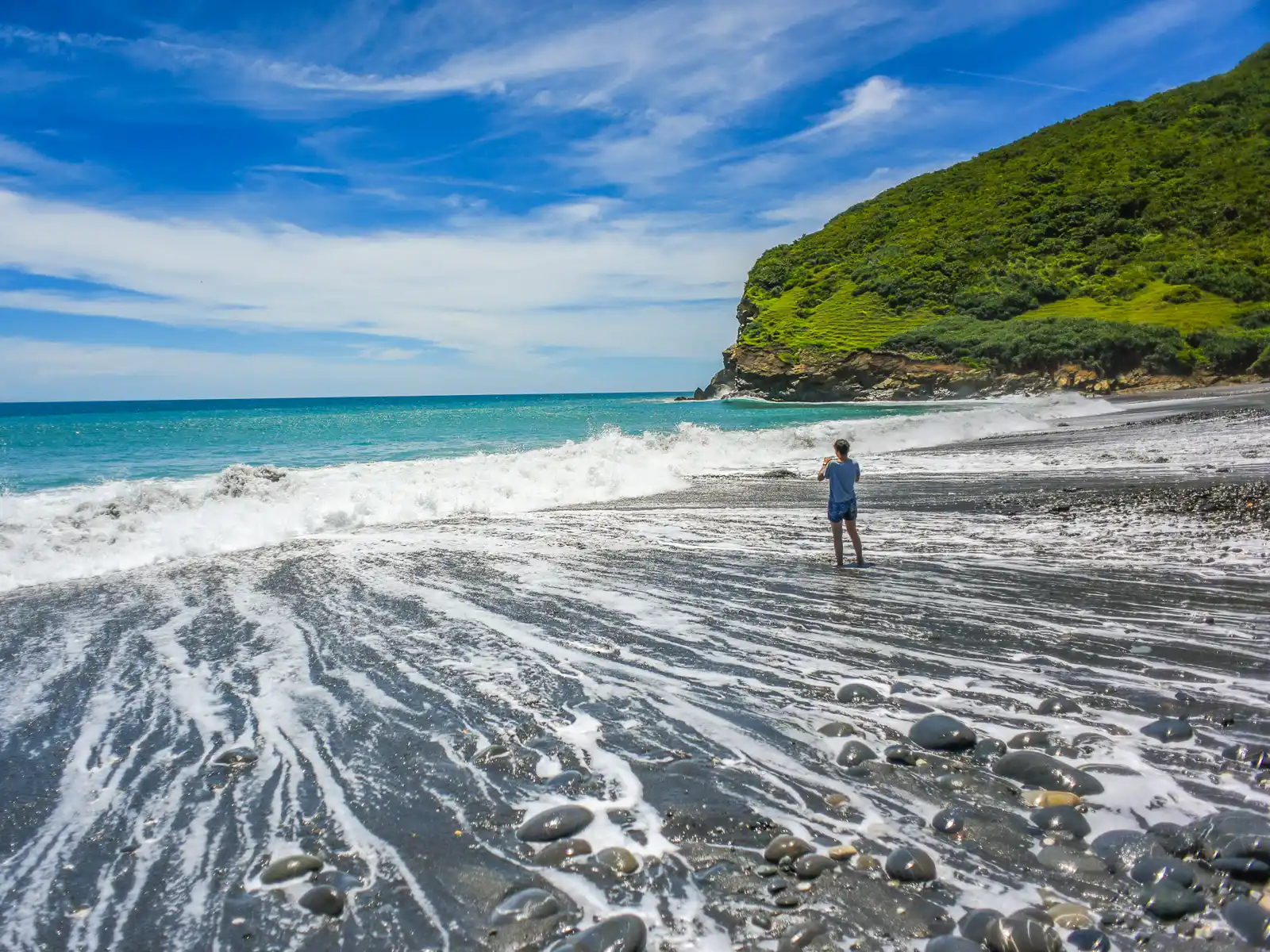
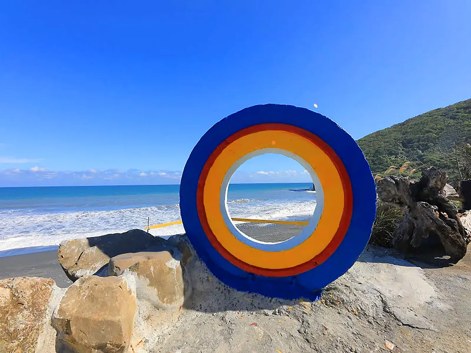
Sandwiched between two ridges, Niushan Beach is one of the largest and quietest beaches in Hualien County. The gentle hills that surround this black sand cove were once used by local indigenous as grazing pastures for their cows, hence the name “Niushan”, meaning “cow mountain”.
In recent years, due to its remote and unspoiled appearance, the beach was also used as a stand-in shooting location for Japan in the Martin Scorsese film “Silence”.
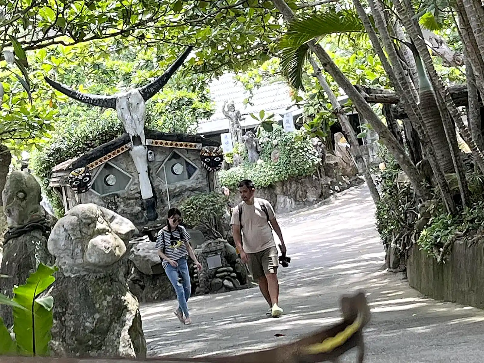
Above the beach area, a private recreation area by the name of Niushan Huting is home to a garden of quirky driftwood art and stone sculptures, and includes a small cafe that serves lunch and refreshments. For those wishing to unplug, off-grid, or just relax under an ocean of stars for a night, accommodations are available in the form of air-conditioned log cabins and a campground.
For more information on lodging options, please refer to the official Facebook page.
Shitiping Recreation Area
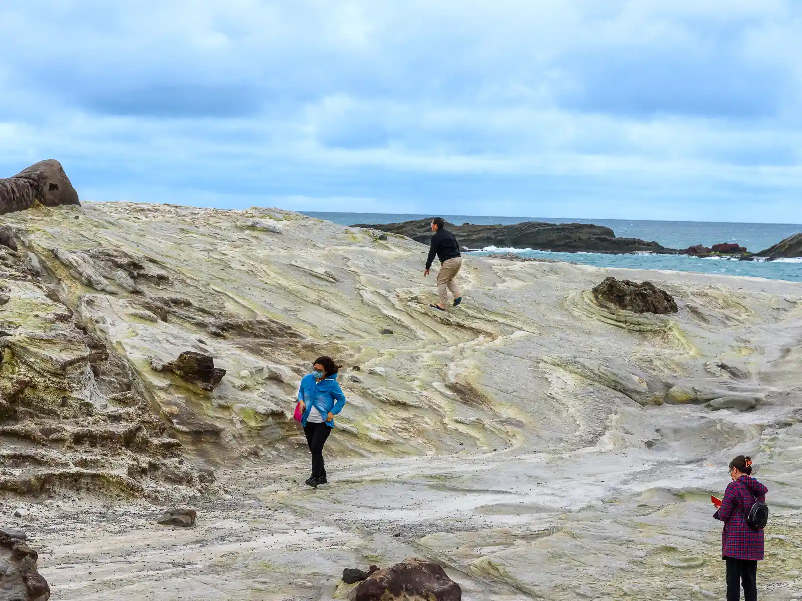
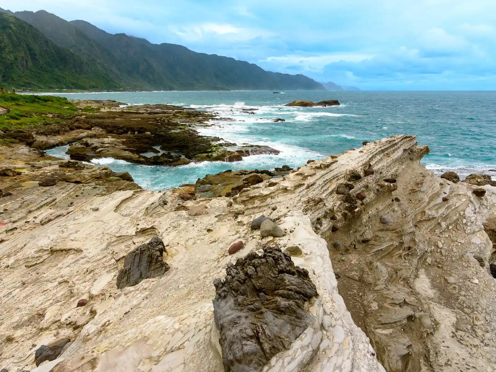
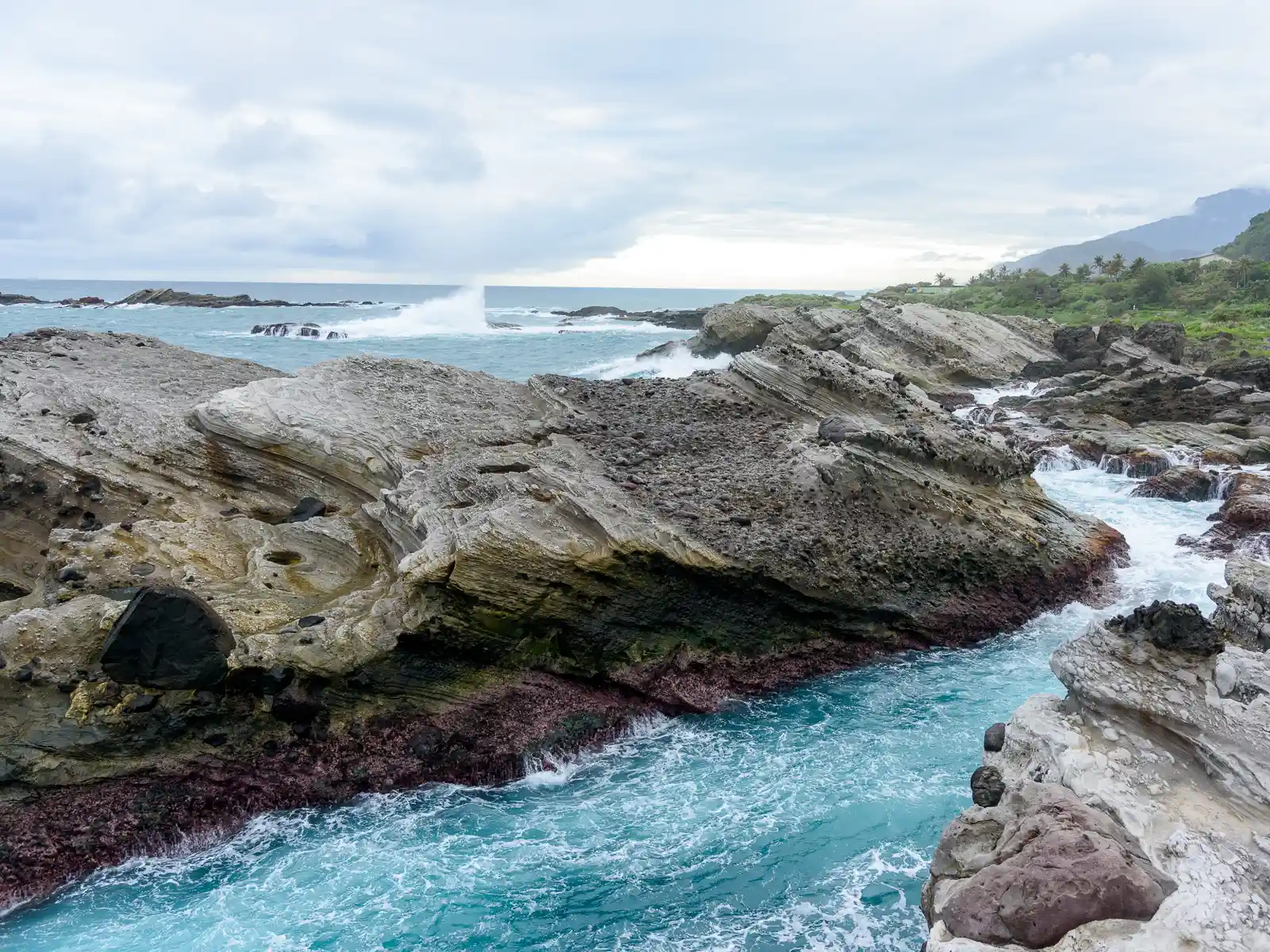
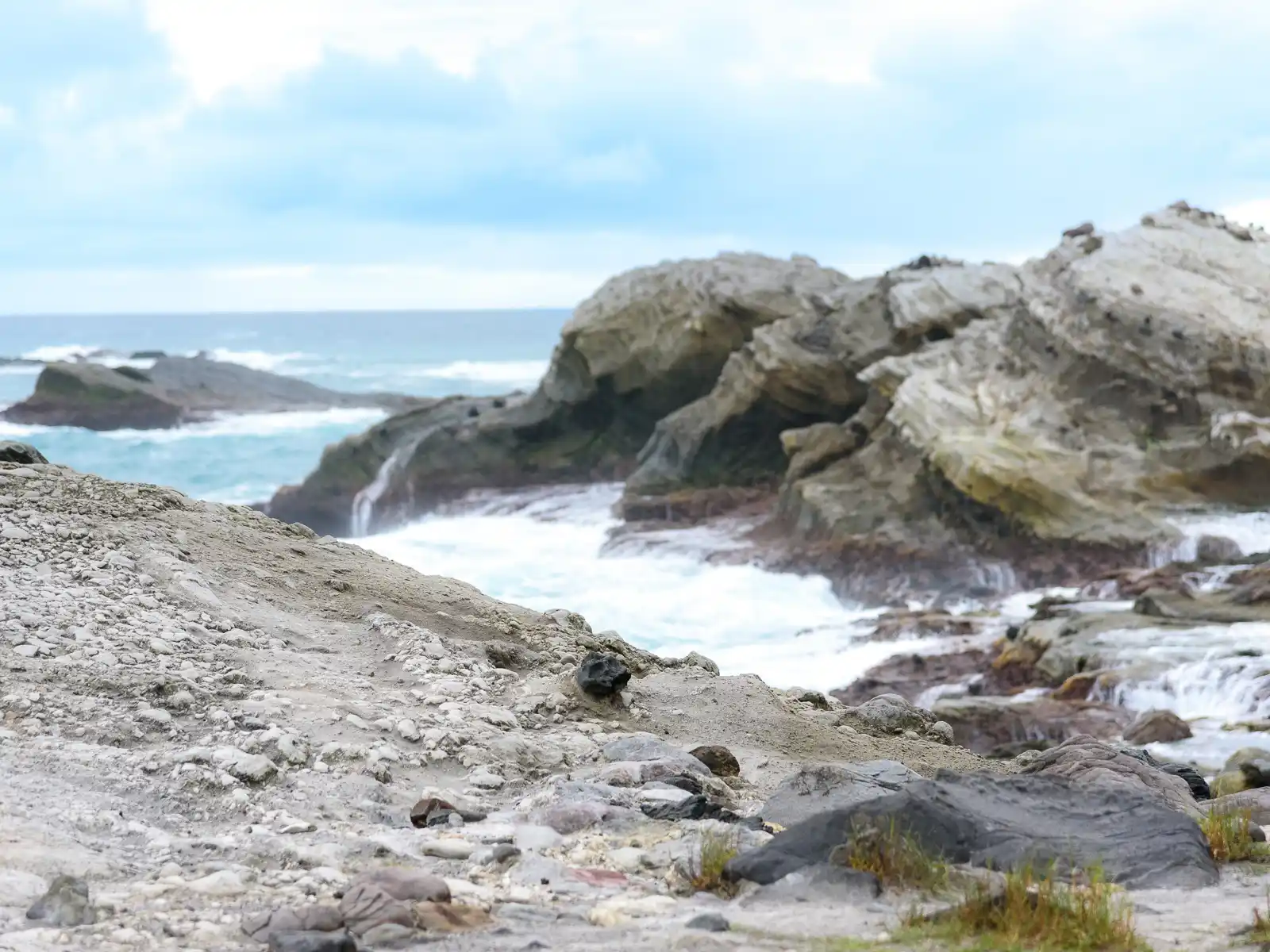
Shitiping is a picturesque geopark that features volcanic rock formations uniquely distinct from the rest of the Eastern Coastline, as well as a wonderful snorkeling and diving area, and an educational intertidal zone.
The overall shape of the land is that of a cuesta, or a rising headland that then drops steeply into the water, however, the steep drop-off has been eroded into what appears to be stone steps leading out of the water.
Exploring the intertidal zone is best done during low tide. The types of life you can observe changes as you shift your gaze from the high tide line to the low tide line. Close to the top you can see barnacles and below that oysters. As you move into the water-filled tidal creeks, enjoy viewing sea urchins, giant clams, as well as subtropical fish, shrimp, crabs, and sea cucumbers.
Snorkeling and diving is possible when the sea is calm (usually between June and October), and the recreation area also features a campground with covered platforms. Due to the area’s isolated nature, it is also an excellent destination for stargazing.
Walami Trail & Nanan Waterfall
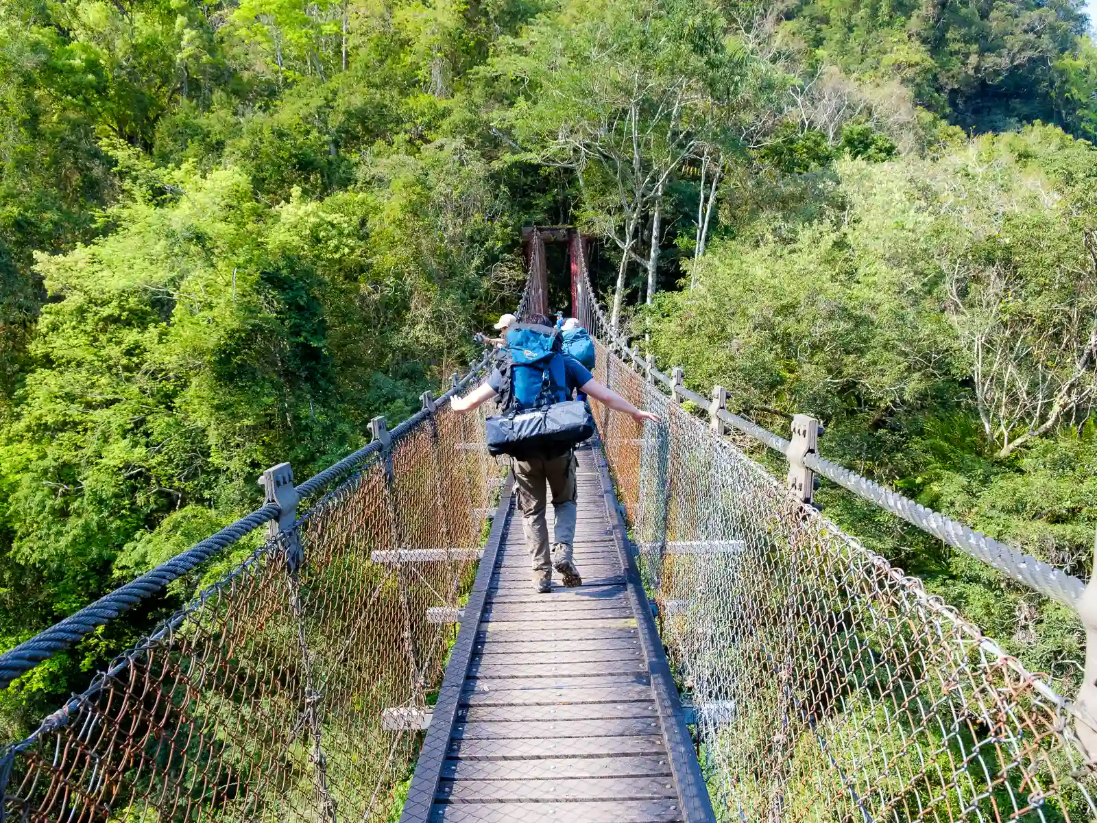
In Southern Hualien’s in Yuli Township, the Walami Trail is well known as being the picturesque eastern entrance to the trail system of Yushan National Park. Leading straight into the wilderness along the cliffs above the Lele River, the Walami Trail is a perfect get-your-feet-wet experience if you don’t have time to apply for permits or plan a longer hike into Taiwan’s mountainous wilderness.
The first 4 kilometers of the trail system may be walked without applying for a permit, and will take you across numerous suspension bridges, over waterfall-filled turquoise creeks, and past some amazing mountain vistas. While the hike is short, it’s also possible to get a taste of the unique biodiversity of Yushan National Park. Wildlife that has been spotted on this section of the hike includes the adorable (but carnivorous) yellow-throated marten, the innocent (but extremely loud) Reeves’s muntjac, and the elusive Formosan black bear.
On the way to the trailhead, a rest area marks the stunning 60-meter-tall Nanan Waterfall which can also be seen from the road. The rest area is home to the last public toilet before the trail.
Sixty Stone Mountain and Chike Mountain (Hualien Flower Festival) *Seasonal*

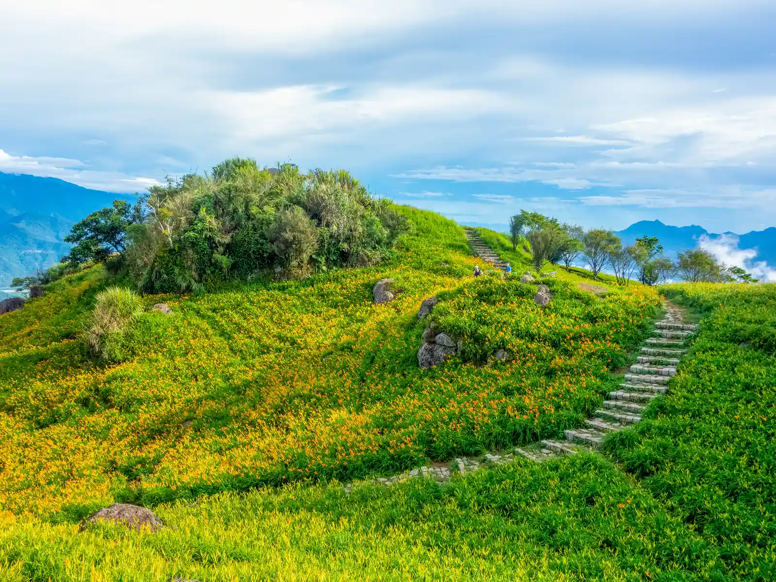
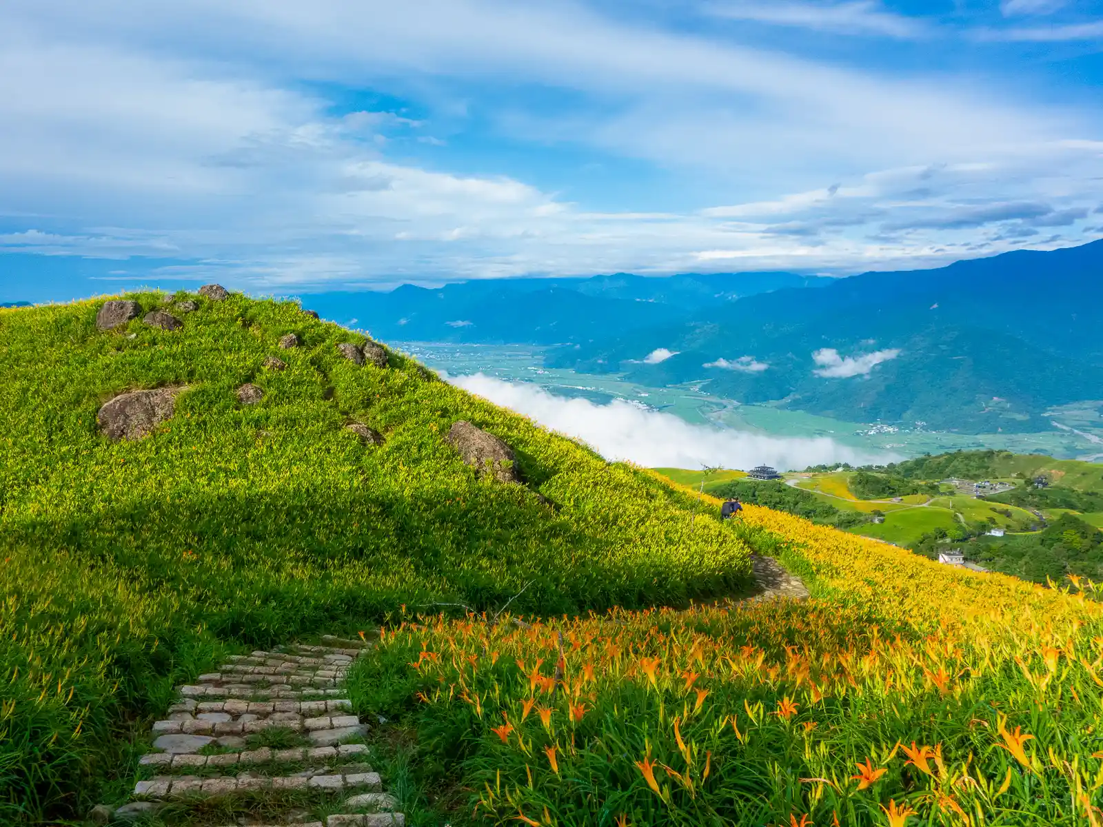
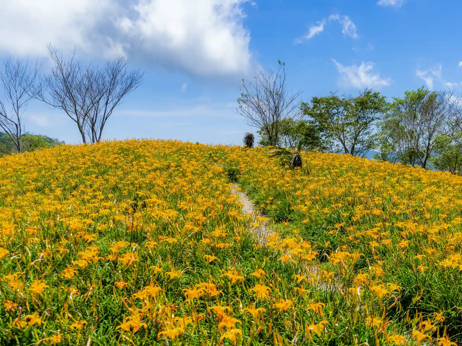
Famous for their rural scenery and vast fields of blooming orange daylily flowers, these two coastal mountains are home to the popular Hualien Flower Festival, also known as the Hualien County Orange Day Lily Season. From late summer to mid-fall, the festival attracts thousands of tourists, including photographers, instagrammers, families and couples, to these picturesque and magical golden fields.
Due to the relatively high elevation of these flower farms, and Sixty Stone Mountain in particular, it’s possible to capture surreal scenes where fields of flowers appear high above the East Longitudinal Valley.
The flower farms here are mostly run by Hakka farmers, and a large majority of them are tourist-friendly. Some farms offer homestay-style accommodations, while others specialize in serving local Hakka fare, including refreshingly light daylily flower soup.
These two mountaintops are also excellent destinations for stargazing and astrophotography. On starry nights, it’s not uncommon to see photographers hiking up to the peaks behind the farms to try their luck at astrophotography or attempt long-exposure shots of the Milky Way, which is visible during the Hualien Flower Festival.
Insider’s Tip: The best time to visit is between the end of August and the middle of September. During this period, most of the fields have begun to bloom, but farmers have not yet harvested the majority of the flowers.